Western Express Day #18 Eureka, NV to Austin, NV
Western Express Day #18
June 18 2021
Eureka, NV to Austin, NV - 71 Miles
Start 5:46AM, Finish 12:56PM
Ride Time: 6:27
Ascent: 2855'
Descent: 3107'
Tour Total Miles: 1202
During last summer’s coast to coast bike tour I had the good fortune in Ovando Montana to spend the night in a teepee. This summer, in Eureka Nevada, I had the pleasure to spend the night in a log cabin. It was historic, dilapidated, missing roof planks, and furnished with crumbling furniture and appliances. Last night at the Owl Club, after uploading my report, I ordered another tall mug of Kilt Lifter and one more cheeseburger and fries. Afterwards I rode uphill back through town to the city park, which I had scoped out earlier. It was listed on my map as a cyclist friendly campground. I noticed a small plot of lush green grass circled by a chain link fence, and beside it sat an old log cabin. There were signs that said no parking overnight and I noticed sprinklers. I didn’t have a phone number to call so I decided to play it safe and stealthy. As comfortable as the grass looked I opted to get my log cabin experience on. I was tired and went to bed early. It was still light out, and my tent was warm. I didn’t set up the fly. In the middle of the night it got chilly and I had to slip into my silk liner. About an hour before sunrise I pulled out my sleeping bag. I had weird dreams, and slept deep. The sprinklers were on this morning, so the cabin was a good call.
Yesterday I had noticed a spigot in the city park which I used this morning to fill my water bottles. I was overjoyed to find that the Chevron station in town was open. I purchased a Starbucks Frappuccino, orange juice, and package of Hostess Jumbo Donettes. While I sat out front of the gas station, I admired the courthouse, opera house, and Jackson House Hotel. I noticed a large E arranged out of white rocks up on the hill. This town had certainly seen a lot of activity during the nineteenth century mining boom. The town's efforts to attract tourists should be commended. Buildings were numbered for an organized tour, and there was free public Wi-Fi and plenty of hotels. On the way out of town I passed remnants of an old mining operation.
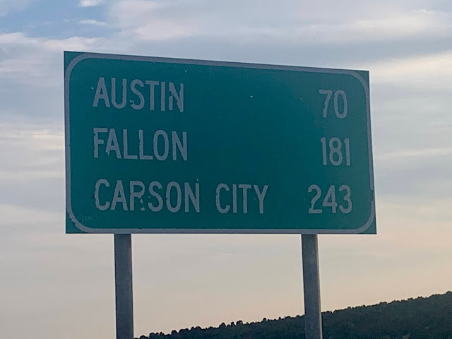
Back out on the highway I got to finish off the second half of yesterday’s Pinto Pass downhill. It was chilly and I was wearing my sweater, short-sleeve jersey, and cycling shorts. I passed the intersection for state Highway 278 and entered another wide open valley. It was partly cloudy and the sun finally broke free on a long stretch towards Devil’s Gate. There would be three passes today and no services the entire seventy miles to Austin.
There had been a rumble strip on the shoulder ever since I crossed into Eureka County. This morning it was taking up half the width of the shoulder, so I rode to the left of the white line, except for when motor vehicles passed.
I was riding alongside miles of scattered sage brush and dirt. I rounded a bend and suddenly noticed green grass and cattle grazing pasture. After a few miles the sage brush returned, and the sage aroma gave me an appetite for pasta. For the past couple of days I’d been observing here a phenomenon where construction pick-up truck vehicles have red bike flags on long rods attached to the roofs of the cabs. It made no sense because the large vehicles themselves stand out, and the tiny red triangles brought no additional visibility. It seemed like these guys were attempting to relive their childhoods.
US 50 traveled in a perfectly straight line for thirty miles. After that my first pass would begin. I suppose it took some nerve to cross such open expanses on a bicycle across a somewhat hostile environment. I had food and water, I had tools, and I was passed by the occasional motor vehicle. That said, I would not want to be doing this in the blazing heat.
I pulled over to turn on my iPod and continued with WFMU’s Nickel and Dime radio with DJ $mall ¢hange who was spinning salsa 45’s. I went up over a small rise and entered Bean Flat. I was slowly climbing and couldn’t feel it. Thousands of hopping Mormon crickets appeared on the road. It was hazy but far off in the distance I could see the snowcapped mountains from the Toiyabe Range.
At 8:30 AM I was halfway to my destination, had a headwind, and was aiming for Morman crickets in the shoulder. I ran into Ryan from Oakland, who was taking the Western Express as far as Baker. From there he was planning to follow an old pony express route and one way or another make it across the country to Maryland. He was staying in cheap hotels through the desert for the air conditioning, and mentioned that there wasn’t much in Austin. He had taken the alternate route from Middlegate, and said the pass was beautiful and promised that I’d see trees. He was enjoying a tail wind today and cranking out the mileage. His Instagram handle was @ryan.kasi
At 9 AM I crossed over into Lander County. I stopped to remove my sweater and drink some water. On my way up the pass I saw a sign for the Hickison petroglyph interpretive area, but I didn’t care to stray from the route. Soon afterwards I reached the summit of 6546’ Hickison Pass. I stopped to document the elevation sign and drink some water. It was 10 AM.
I enjoyed a nice downhill that brought the impressive Toiyabe Range front and center. I reached the next straight which was six miles long to the next curve which led up to the following pass. The rumble strips and headwind disappeared. I reached the end of the flat, and started my next climb. I passed the intersection for Highway 376. My destination in Austin was only twelve miles away.
Heading up towards the pass, I saw the 'chain and snow tires required when flashing' sign. I pulled over to relax my toes and drink some water. I entered the Toiyabe National Forest which my iPhone dictation interpreted as toilet bowl. Ascending up the pass I had a nice cool tailwind, which I appreciated. I was passed by two eastbound cyclist riding down from the pass. The first was carrying nothing and the second had rear panniers. The didn’t seem loaded for distance and I didn't believe they were going far. We gave each other the thumbs up, and I didn’t stop to meet them.
There was no elevation sign for 7267’ Bob Scott Summit. A sharp downhill began immediately, where I sped 42 miles an hour. My spoke magnet once again slipped out of alignment and the Mormon crickets returned. There was a second pass which I immediately began climbing. I spotted a picnic table in the nook of a switch back, about a mile and a half and 700’ elevation from the summit. I pulled over to take off my socks and give my toes a break.
On my final stretch up the pass I enjoyed the view of grass covered rounded hills across the valley to my left. The tailwind was keeping me cool and in good spirits. I stopped to take a photo at the top of 7484’ Austin summit. It was a three mile descent to my destination. I passed a warning sign for a 6% downhill grade, and left the Toiyabe National Forest. Soon could see the town below. I entered Austin, population 192 and elevation 6575’. It was the geographical center of the state.
I went to the dilapidated International Cafe, where I ordered a BLT and several Cokes. The proprietor was a cranky misanthrope, who upset me with her rude behavior, language, and political tirade. Afterwards I surveyed the town and there wasn’t much. I stopped by the The Pub, where I eked out two bars on my mobile hotspot plan to edit and upload today’s report. For some reason, my Cyclemeter GPS map and elevation data today was cut short. The bartender, Jessica, was the nicest person in this hard-scrabble town. The owner later showed up with two of his friends, and Jessica’s husband arrived with their two boys. Everyone drank margaritas and I was entertained by the local color. There was much talk about the Mormon crickets. I heard about a pony express reenactment, and I’d unfortunately be missing tomorrow's rib fest.
I was hoping for some dinner and went next door to the Owl Club. The cook hadn’t shown up for their shift, and they weren’t serving food, so I rode back down to the International. She only served lunch. I cycled down to Champs gas station where I purchased a Hilshire Italian Dry Salami Snack Pack, a bag of Bugles Ranch Crispy Corn Snacks, and a 22 ounce bottle of Heineken. Austin Nevada was one of the suckiest places that I've ever visited on a bike tour.


Comments
Post a Comment