Western Express Day #21 Fallon, NV to Carson City, NV
Western Express Day #21
June 21 2021
Fallon, NV to Carson City, NV - 71 Miles
Start 6:06AM Finish 5:35PM
Ride Time: 6:30
Ascent: 1522'
Descent: 887'
Tour Total Miles: 1400
Details at: https://cyclemeter.com/3f1ef27914a4c684/Cycle-20210621-0606-80627
I slept well at site 42 in the Churchill County Fairgrounds. It was still warm when I retired to my tent, and at some point during the night I slipped into my silk liner. I don’t believe that I used my sleeping bag. Before I went to bed I talked to my neighbor for a bit. He was traveling in an RV, was retired, widowed, and roaming around. He had just gotten a new tattoo on his back from a local artist, and mentioned that it was still tender.
This morning the sun was still low on the horizon when I rode back out through town, and I was shaded by the trees and houses. I was wearing my cycling shorts and short-sleeve jersey and I felt comfortable. I followed US 95 north back up to US 50 where I took a left and headed west through the sprawl where I’d been yesterday. In addition to shopping malls, fast food places, gas stations, and hotels, there were casinos.
As the sprawl thinned on the west end of town, I was joined by a railroad track that saddled up next to the right side of the highway. I was no longer in the shade. On the far edge of town I stopped at Skips Mini Market, where I purchased a Starbucks Frappuccino and an orange juice. There was farm equipment for sale along the highway and it smelled like cattle. I was paralleling the Carson River to my left. I passed a series of religious signs to the right in someone’s yard.
A large white airplane icon appeared in the shoulder. What? In addition to the four lanes of motor traffic was I now supposed to be concerned about planes landing on top of me? US 50A continued northwest towards Reno and I split off west on two lane US 50 towards Carson City. Today on my map panel there was quite a bit of blue, which I hadn’t seen in awhile. Most prominently was the large Lahontan Reservoir. In addition there was the Carson River, the Sheckler Reservoir, and Soda Lake. In terms of full-on desert experience, I think yesterday was it. Back in the day, Fallon had been known as Rag City. After crossing the forty mile desert, travelers would bathe and launder in the Carson River. They hung up their clothing to dry in the sage bushes, and hence the name.
I was now a day away from the Sierra Nevada Range and here there was water runoff, which created verdant valleys. It was once again a sustainable region. The cantankerous woman in Austin had claimed that their existence in central Nevada was unsustainable. As temperatures rise, that might be true for much of the west. I had wooden utility poles and wires on both sides of the road today. The train track continued to my right and Lahontan Reservoir appeared to my left. The land was still mostly sage brush and dirt.
The highway split west away from the reservoir and crossed up over into Lyon County. I was beginning to experience a headwind and a rumble strip took up the entire shoulder. I crossed up over a small ridge. Coming down into the valley on the other side I spotted Silver Springs with it’s trees and buildings in the distance. I entered Silver Springs, population 5296 and elevation 4207’. It was 81°F at 8:30 AM.
I stopped at Spring Market, right across the roundabout from the Nugget Casino and the Silver Strike Casino. I purchased a Starbucks Cold and Crafted and an orange juice. The Silver Strike was offering an all-day breakfast and I didn’t stop. US 50 was a four-lane divided highway. I saw a sign for interstate 80 which was eighteen miles to the north.
The highway headed in straight line directly west across the valley for fifteen miles. I rode down a slope into Stage Coach, no population listed with an elevation of 4319’. There were no passes indicated on my route today, but after Stage Coach I climbed up towards a small ridge and had a headwind. I passed a snow tire and chain required when blinking sign, and pulled over to apply sunscreen and turn on my iPod. After summiting the ridge I turned a corner and could see the town of Dayton ahead in the distance. I felt spoiled today by all the service options. There were mini markets and gas stations virtually the entire ride.
I’ve crossed nearly a hundred cattle grates on this tour. I’ve also crossed several fake ones. They’re set up with the same with the warnings on the side of the road, but instead of metal grates, white lines are painted across the highway to mimic cattle grates. Towards the west I could see large mountains with patches of snow. Ostensibly I was seeing the Sierra Nevada range up near Lake Tahoe, where I would be tomorrow. I passed another airplane icon painted in the shoulder.
I’ve seen a lot of warning signs for dust, including one that said Dayton was Dust Devil territory. Back in the day, Dayton was known as Chinatown. I stopped at the Pioneer Crossing Casino for breakfast, where I ordered eggs over-easy, bacon, home fries, wheat toast, and two orange juices. I was back on the road by 11:30 AM and it was 90°F. Dayton identifies itself with Nevada’s first gold discovery back in 1849. Dayton’s population is 8964, and it’s elevation is 4400’.
The road split away from the river and went up over a ridge. It was still four-lane divided with lots of traffic, and it was starting to get hot. At the top of the hill I could see Mt. Bullion to my right and the small town of Mound House was ahead in the valley. I crossed into Carson City County but didn’t see a sign. Mound house had no population listed and it’s elevation was 4913’. I passed a sign that read ‘Sacramento 140 miles’. Wow!
I climbed up over and another ridge and entered Nevada’s state capital Carson City, population 55,439. I rode down into a valley filled with trees and grass, and a huge mountain range to the west. I stopped at a Maverick for a large Coke on ice. Carson City was originally called Eagle Station.
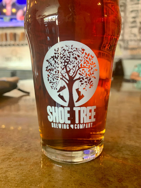
I rode into town and went to Bike Smith to have my tire pressure checked. My rear tire was 60 PSI and my front was 40 PSI. I had both inflated to 80 PSI and the mechanic recommended the Shoe Tree Brewery, which I later learned was named after the shoe tree in Middlegate. I rode over to the brewery and ordered several pints of the Ash canyon Amber. I heard that there were several other shoe trees located in the area. A customer at the bar offered me sumptuous smoked venison. Today was the summer solstice, and I was overjoyed to be on another epic bike tour.
I arrived at my Warm Showers hosts Joan and Greg in a beautiful old neighborhood in Carson City. They had a wonderful compound and I was given my own bungalow. I showered, shaved, and did laundry, and then we sat out back and had a few beers. We went to the Union where I enjoyed the Shishito Peppers and a Carson Burger, along with a few Happy Days IPA. I learned that Joan and Greg were burners, and they shared their photos with me. I felt blessed to be here with these awesome people.


Comments
Post a Comment