Western Express Day #2 Westcliffe, CO to Maysville, CO
Western Express Day #2
June 2, 2021
Westcliffe, CO to Maysville, CO - 61 Miles
Start 9:11AM, Finish 6:30PM
Ride Time: 5:55
Ascent: 2492'
Descent: 1811'
Tour Total Miles: 116
I slept incredibly well at the Courtyard Country Inn in Westcliffe. It was my best nights sleep since I got to Colorado. Before turning in I cranked up the heat to dry out all my wet gear. I attempted to charge my devices and realized that I only brought one charging cable for my portable charger. I always bring an extra, but the additional one I packed was the wrong kind. These cables are finicky and my power pack didn’t charge a single percentage point during the night. This morning I turned off the heat and cracked open the door. My lips were chapped from the dry humidity. With the daylight I could admire the charming little hotel with it’s lush garden and funky decorations. I met two guests in the courtyard and asked for breakfast suggestions. They had seen me last night at Tony’s, and told me to avoid the small tourist places and go to the bowling alley. On my way I was blown away by the sweeping views of the snow capped mountains. At the bowling alley I had The Perfect Game- eggs over-easy, bacon, hash browns, toast and orange juice. Afterwards I stopped at the supermarket to buy aloe vera gel for my sunburn. I was at the end of highway 96, which I could now brag that I’ve cycled all the way from Rush City Kansas to Westcliffe, CO. I now headed north on State Highway 69.
I was wearing my short-sleeve jersey, cycling shorts, and UV arm covers. It was chilly but the sun was strong. I was riding alongside cattle grazing pastures and worn buttes, with the Sangre de Cristo Mountain range to my left. Highway 69 cuts through the Wet Mountain Valley, and I noticed numerous homestead log cabin structures in various states of dilapidation.
I stopped to visit the Beckwith Ranch, and learned about the history of German and English immigrants duped to settle this area in the 1870’s. I passed an antelope resting in the grass, that wasn’t startled when I took it’s photo. After 14 miles I entered Fremont County and the town of Hillside, which I never saw. I took a left on County Road 18 towards Cotopaxi.
I ran into eastbound cyclist Philip, whom Melissa had told me about. He had started in San Francisco, and was going cross-country to Yorktown, VA. He would be picking up the TransAm route in Pueblo. He was staying in hotels and doing heavy mileage. He mentioned that yesterday on Monarch Pass he rode through snow. He was aiming to get to Pueblo today.
I had a steep descent down into the Arkansas River Valley. I braked frequently and took it easy. I was surprised that my brim didn’t blow off from the wind. I stopped at the Cotopaxi store and bought myself a Gatorade and a freshly baked muffin. The roaring Arkansas river was before me along with gorgeous red rocks from the canyon. I turned onto US 50 West, which I would follow for much of the tour. I could expect more towns and services along US50, but also more motor traffic. I passed numerous rafting tour outfits as I rode alongside the Arkansas River heading upstream.
There was construction in the canyon with one lane closed and alternating one-way traffic. A pilot car led packs of motorists through. This acted like a valve and calmed motor traffic, making it more relaxing for me. It began to get hot but there were clouds in the sky. The next town was Howard. I noticed services but I didn’t stop. West of Howard I spotted the tour’s first TURD flag.
At 1:30PM, as I entered another narrow winding canyon, I started feeling raindrops. I spotted kayakers in the river below. I stopped to read an information sign about Zebulon Pike who had unsuccessfully tried to find the source of the Arkansas river. I then then entered Swissvale. Across the river I spotted the more industrial town of Wellsville with it’s giant white mounds of lime. The sun came back out and it got toasty again. I then crossed the Chafee county line.
I entered Salida, population 5036 with an elevation of 7036’. It was the largest town I’d seen since Pueblo. There was a giant S created from white rocks up on a hill. I was greeted with sprawl, which was my fault. I had stayed on US 50 in search of a brewery instead of sticking to the route. I went to Soulcraft Brewery and enjoyed a few pints of All Mountain Amber with Happy Hour prices. I sat out back in the garden and edited this report. It was a beautiful afternoon and I was starting to hit my touring groove.
The Arkansas River splits in Salida and I was now following the South Arkansas River. Just outside of Poncha Springs I momentarily left US 50 to get on the bike trail that I was supposed to be on. I passed the Elevation Beer Company and was tempted. All of the businesses around here have their names and logos etched into large boulders. The bike trail was short lived.
In Maysville there was a ski rental place that was closed for the season and a KOA campground. I’m not overly fond of KOA so I continued a few more miles to an RV park. It was still quite warm. There were dark clouds above the pass ahead of me. I passed signs saying Road Work Ahead Next 20 Miles. I then noticed a sign that read Chain Station, which indicated a large pass ahead. Then I pedaled past a gate capable of closing down the highway in case of a severe storm. I was at the base of Monarch Pass, which I would be crossing tomorrow.
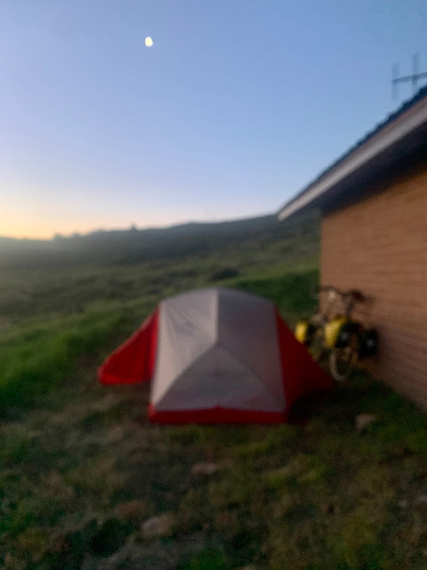
I saw a nice area down by the river and considered stealth camping. Instead I continued down the road to Monarch Spur RV Park. I wasn't sure if campsite #7, with it's rickety picnic table, was worth $25. There was nothing available at the camp store, but at least there was limited WiFi. I camped next to a small stream and less than a hundred yards from US 50.


What’s a TURD sign?
ReplyDeleteWhat’s a TURD sign?
ReplyDelete